Landscape maps
Madonie landscape maps
Madonie landscape maps are:
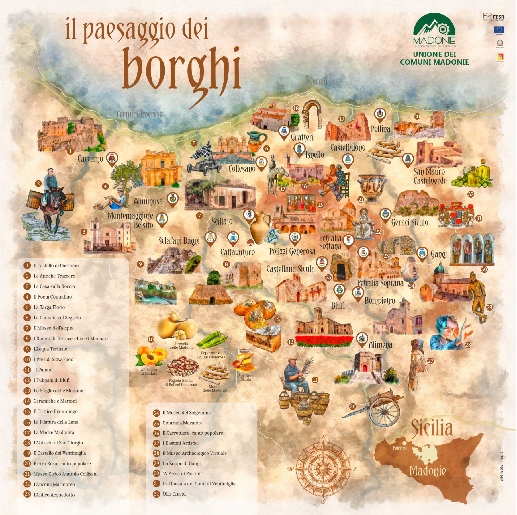
Villages landscape
Small realities, immersed in the quiet of nature, with churches, monuments, remains of historic buildings, castles and fortifications, rural archeology and diversified cultural itineraries. They are places of feeling, of peace and of the rediscovery of small and big stories which together are the very history of Sicily.
Click on the image to access the detailed map or download brochure.
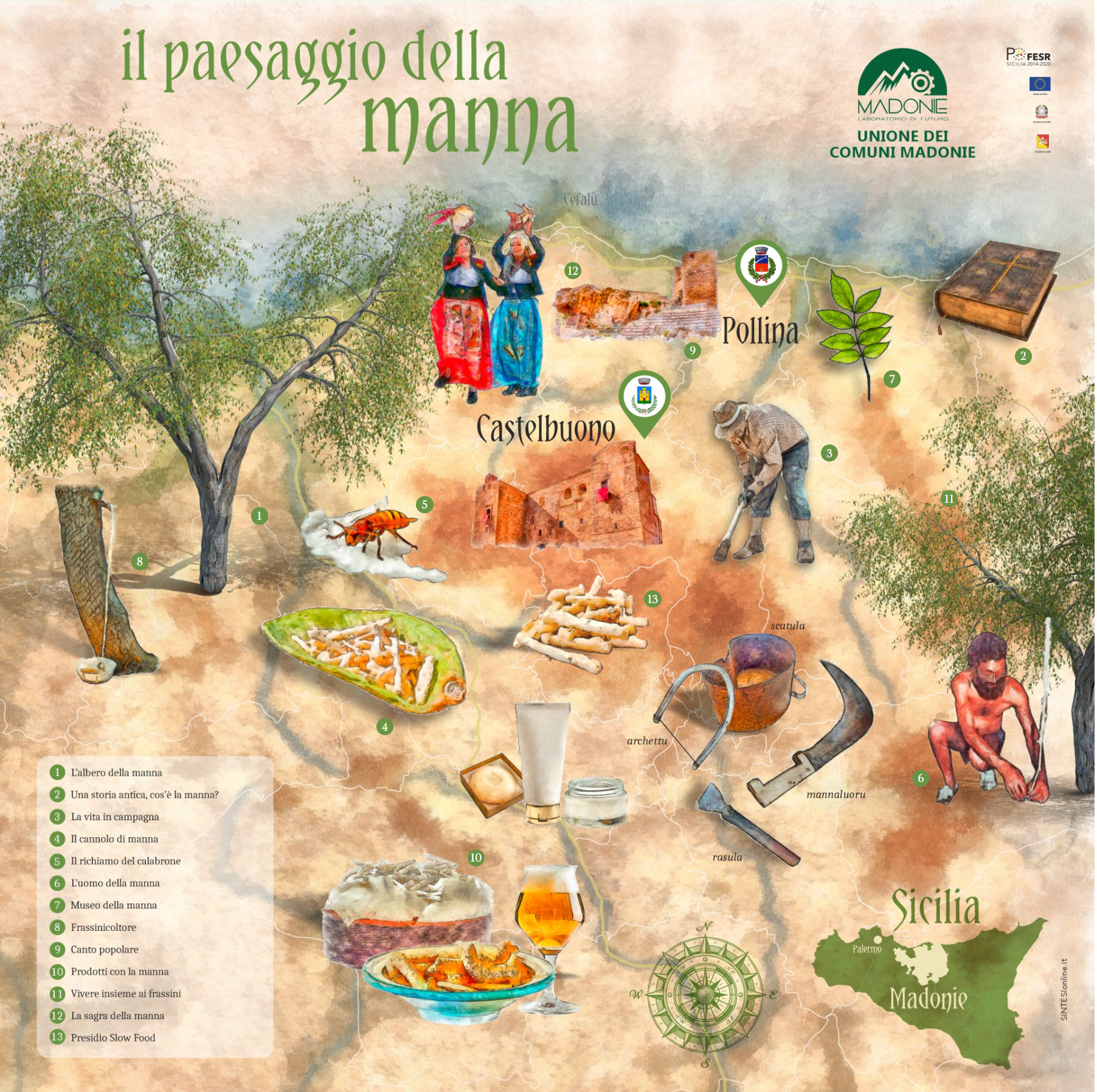
Manna landscape
Between Pollina and Castelbuono we find traces of manna ash trees, a variety known by the name of "ash", from whose trunk - by means of an incision - a whitish sap with a stalattiform appearance is extracted which, solidifying, gives rise to the manna. The harvest season runs from July to September. In recent years, this art has undergone a phase of rebirth, the result of the efforts and will of some farmers.
Click on the image to access the detailed map or download brochure.
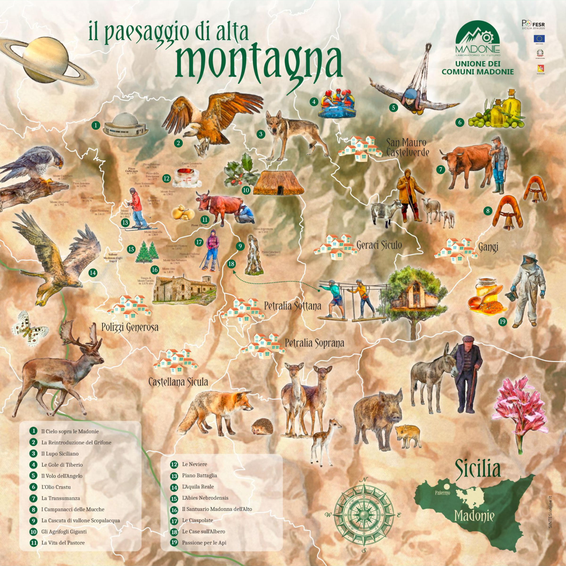
High mountain landscape
The Madonie represent, by birth and orographic formation, the synthesis of many of the aspects of the island territory. Located in the central-northern part of Sicily, they overlook the Tyrrhenian Sea, connecting with the Nebrodi Mountains, to the east, through the Fiumara di Pollina; while in the West only the wide valley of the northern Imera River interrupts their path.
Click on the image to access the detailed map or download brochure.
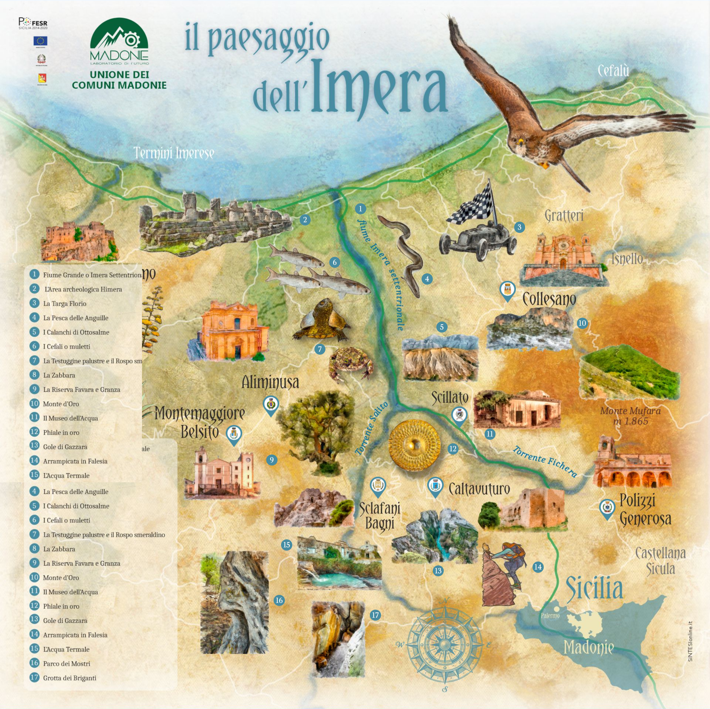
Imera landscape
With its 35 km length, it crosses different types of land (hazelnut groves, olive groves and fruit trees), until it flows into the Tyrrhenian Sea. Places of peasant memory and traditions, but also territories that take you back millions of years. On the Madonie mountains, the show is guaranteed.
Click on the image to access the detailed map or download brochure.
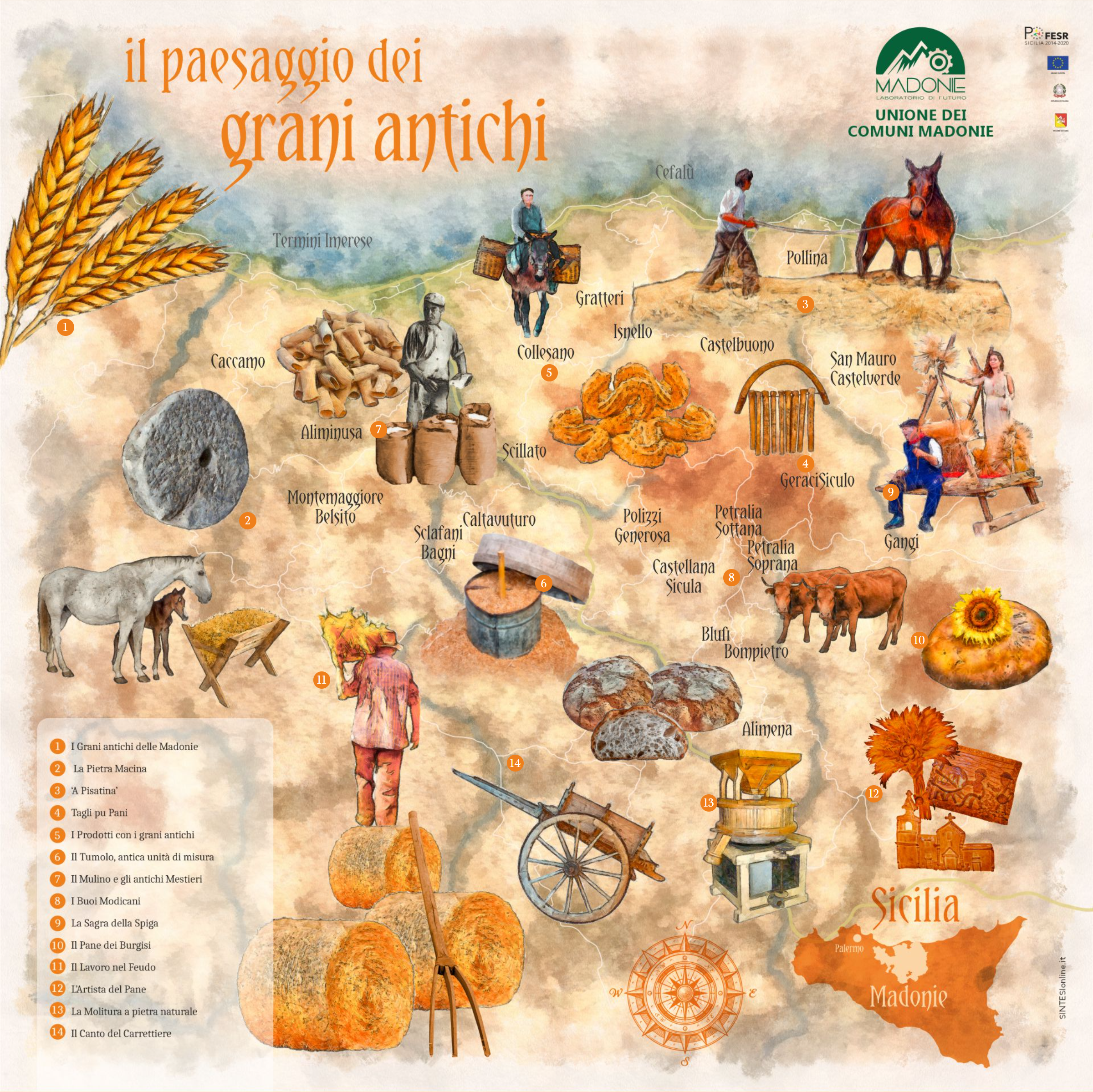
Ancient grains landscape
The Madonie area is also characterized by the rediscovery and enhancement of the so-called Ancient Grains, varieties of wheat which, over time, have not undergone genetic modifications and selections by man, remaining in their original nature. The ideal place to rediscover them, without forgetting the added value represented by the centenary peasant tradition.
Click on the image to access the detailed map or download brochure.
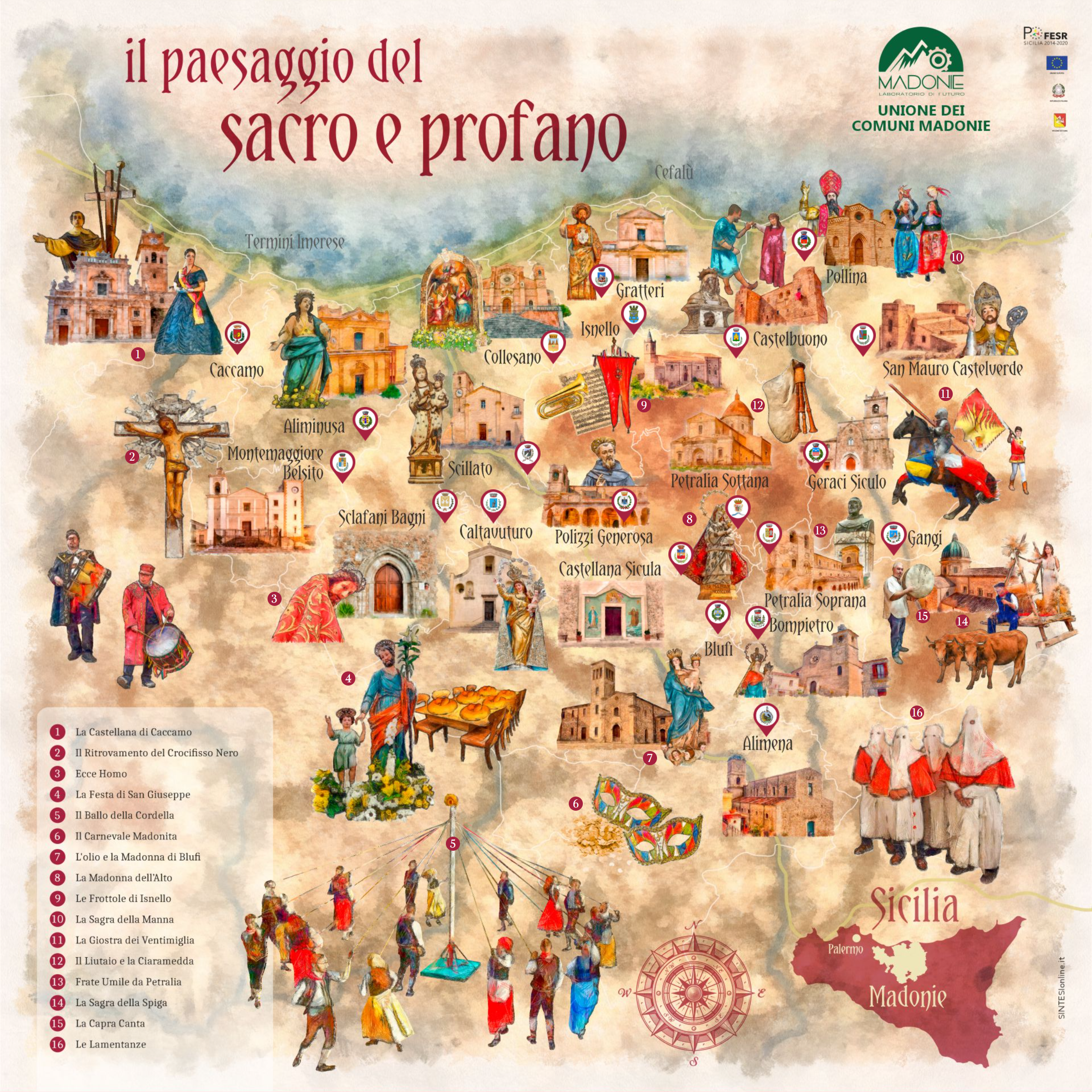
Sacred and profane landscape
Places of worship and memory of faith which over the centuries have represented a point of reference for peasant communities, as well as a tangible sign of the strong religious sense which, still today, reproduce the authentic spirit of devotion. An authentic testimony between faith and rituals that fascinates visitors.
Click on the image to access the detailed map or download brochure.
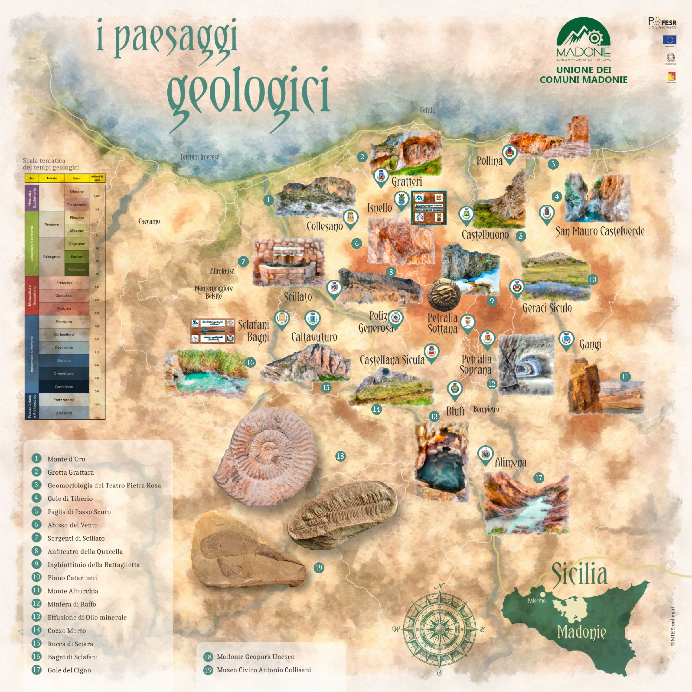
Geological landscapes
The Madonie represent an opening on the geological history of the central Mediterranean, which began millions of years ago. It constitutes an extraordinary laboratory for geologists and scientists. It is a route inside the city center and in the immediate vicinity that stimulates the curiosity and imagination of even less experienced visitors. One does not remain insensitive to the beauty of these landscapes.
Click on the image to access the detailed map or download brochure.
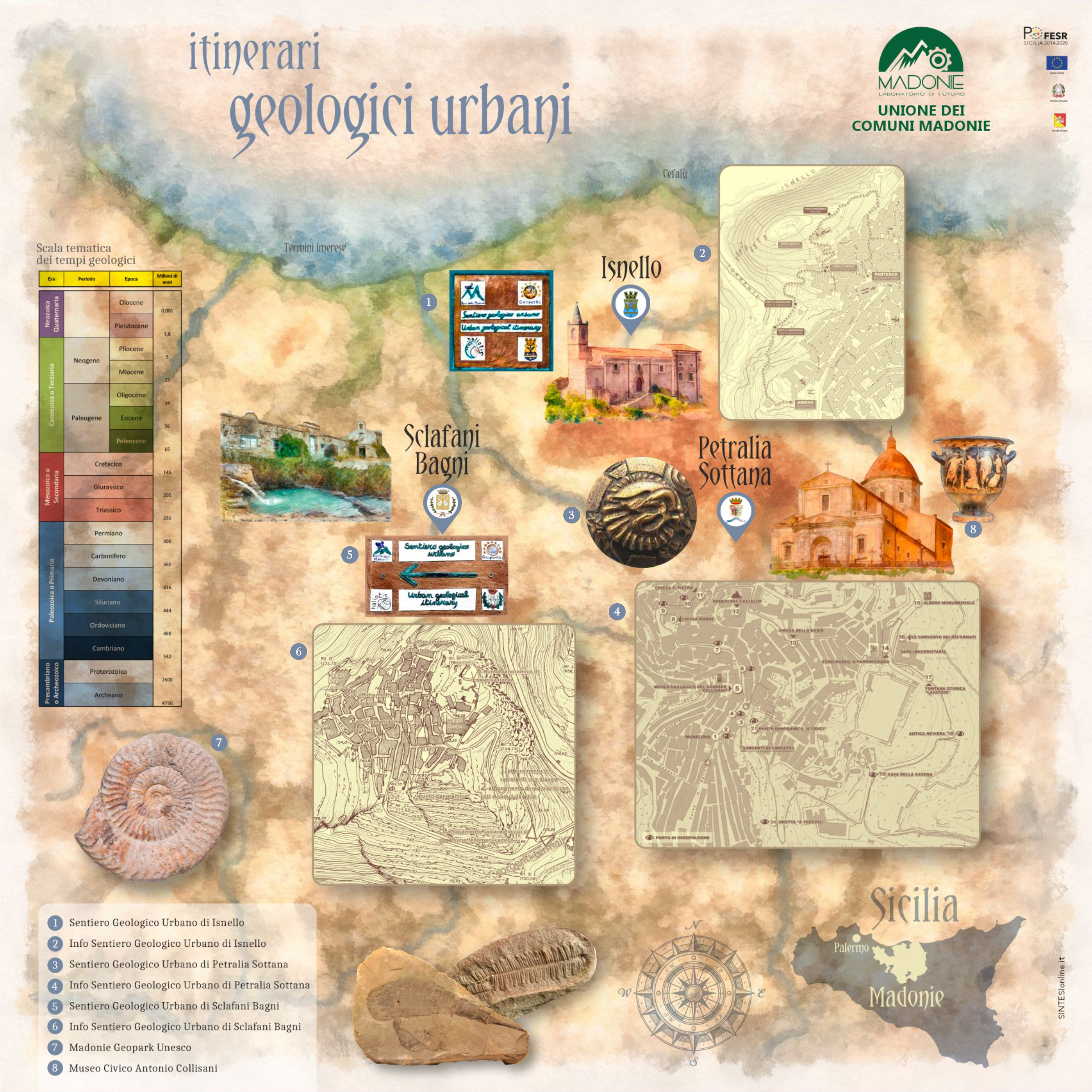
Urban geological itineraries
The Madonie territory has many interesting geological aspects. The itineraries already present are found in Isnello, Petralia Sottana, Sclafani Bagni. These paths tell us the story that we find in the rocks and in the landscape. Only there is it possible to trace the processes that have followed one another over millions of years, and how they have been important for the maintenance and development of the community.
Click on the image to access the detailed map or download brochure.


